Dataset
Antarctica Circumnavigation 2019 surface and ADCP measurements
Geography
Southern OceanDate Range
2019-01-17 to 2019-08-03License
Citation
https://data.saildrone.com/id/2091
Latitude
-60.99 to -46.43Longitude
179.99 to -179.99Related Links
- Overview
- Variables (35)
- Data Access
Platform
Platform IDs
Summary
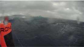
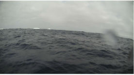
This data set was collected during the first Saildrone Antarctic Circumnavigation. A fleet of three Saildrone unmanned surface vehicles (USVs) were launched from Bluff, New Zealand on January 19, 2019.
One USV (SD 1020) was equipped with a pCO2 sensor suite (ASVCO2, developed by NOAA PMEL) and a 300 kHz ADCP. The two other USVs (SD-1022 and SD-1023) were equipped with scientific echo sounders (SIMRAD EK80 WBT mini). All three vehicles also carried the standard Saildrone atmospheric and oceanographic sensor suite.
SD 1020 was the first vehicle to complete the circumnavigation and was recovered in New Zealand on August 3, 2019, after 196 days and sailing more than 22,000 kilometers. SD 1022 and SD 1023 were damaged in the first 24 hours of the mission in winds gusting over 50 knots and 20 foot waves and had to return to New Zealand for servicing. They were relaunched on May 10, 2019.
Scientific objectives for SD 1020 included studying air-sea flux, ocean acidification, and meteorological data collection for use in weather forecasting and ecosystem modeling. SD 1022 and SD 1023’s science objectives focused on krill and biomass studies.
This Antarctic Circumnavigation data set contains Saildrone platform telemetry and near-surface observational data at 1-minute to 1-day resolution in NetCDF format, and ADCP current data binned temporally at 5-minute resolution.
Spatial Coverage
Longitude 179.99 to -179.99
License Terms
Images
2019-03-02T22:30:34.000Z

2019-03-03T14:30:34.000Z
2019-03-26T15:43:34.000Z