Dataset
2018 West Coast Survey
Geography
West Coast (US / Canada)Date Range
2018-06-27 to 2018-11-27License
Citation
https://data.saildrone.com/id/2089
Latitude
32.3 to 50.67Longitude
-129.01 to -117.24Related Links
- Overview
- Variables (31)
- Data Access
Platform
Platform IDs
Summary
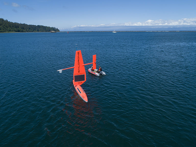
The 2018 West Coast Fisheries Survey is the first time autonomous wind and solar-powered vehicles have been used to gather essential data on fish populations. Five saildrones (SD 1024, SD 1025, SD 1026, SD 1027, SD 1028) traveled more than 18,500 nautical miles over 100 days along the US west coast. Four of the saildrones duplicated the path of the NOAA research vessel Reuben Lasker collecting data on sardine, anchovy, and hake, one of the West Coast’s most valuable commercial fisheries. The fifth saildrone collected data close to shore in areas too shallow for the ship to safely navigate.
The goal of the mission was to augment ship-based fish stock assessments and answer questions about whether autonomous data collection can improve the effectiveness and efficiency of fisheries management on the West Coast. Two of the saildrones were launched from Neah Bay, WA, and three were launched from Alameda, CA. Each of the vehicles undertook specific missions related to improving the efficiency and accuracy of fish stock assessments, including the vertical migration and schooling behaviors of various fish species.
The landmark survey, which wrapped up in November 2018, is the result of a collaboration between NOAA’s Northwest and Southwest Fisheries Science Centers, NOAA’s Pacific Marine Environmental Laboratory, Fisheries and Oceans Canada (DFO), and Saildrone.
This dataset is hosted by NOAA PMEL and contains the atmospheric and oceanographic variables from the mission. Echo sounder data is not included.
Spatial Coverage
Longitude -129.01 to -117.24
License Terms
Images